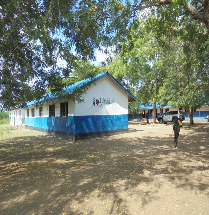
About Us
Garsen Constituency
Garsen Constituency is sparsely populated with a population density of 6.197 people/km2. It has an approximate total population of 96,664 people with a growth rate of 3.4% per annum and a poverty index of 76.9%. Of this population, 50.38% are male with the rest being female. Life expectancy is at 52.7 years with a very high fertility rate evident in household size of 4-6 members at 42% and. The population is generally youthful. The constituency is populated by the Pokomo (farmers) and the Orma (pastoralist).
Human settlement is influenced by urbanization with 7% living in urban areas, climatic conditions, soils and accessibility to water points. Most villages of farming and fishing communities are found along the Tana River wetlands.
The pastoralists live in manyattas which are found in the hinterland in areas with animal watering points and pasture. The pastoralists migrate frequently between Garissa county and the Tana river county depending on the rainfall patterns. Nearly 93% of the people in Tana Delta live in rural areas. The main source of livelihood amongst the people include crop farming and fishing along the river and within the delta and livestock keeping.
The sub county receives low bimodal and erratic conventional rainfall ranging from 300mm and 900mm. long rains occur between April and May while short rains occur in October and November. The Inter Tropical Convergence Zone(ITCZ) determines the amount of rainfall at the coastline.
The higher level of rainfall along the coast line support crop production especially around Kipini where cash crops such as cashew nuts, cotton, mangoes, bananas and maize are grown. In addition, it also supports the mangrove forest in Kipini which is a major source of forest products.
In the southern the average temperatures are 30*c with humid conditions along the coastline. The hinterland parts experience dry conditions which support wildlife and nomadic life style.
River Tana transverses the constituency from Mnazini in the north to the Indian ocean in the south east. As the river transverses downstream, it creates an expansive delta covering about 1,300km2, largely characterized by wetlands and oxbow lakes.
The delta presents great potential for agriculture. it is also a natural habitat for diverse flora and fauna forming and ideal ecosystem for ecotourism. THE delta hosts over 1,500 migratory birds from69 bird species. The delta is ideal for grazing during the dry season. It also supports irrigation, the main crops being rice, mangoes, maize, bananas, and soya beans. In addition, there is fishing, forestry and agroforestry.
Apart from Tana River there are several seasonal rivers popularly known as lagas that transverse the district. These rivers originate from Kitui county draining their waters to the Indian ocean. The beds of these rivers support livestock and are bests sites for shallow wells, pans, and sub-surface dams, although they are major bottle necks to road transport.
The constituency has a coastline characterized by sandy beaches interrupted by the Tana delta. These sandy beaches are ideal for beach tourism.
Access NG-CDF Information on your Mobile


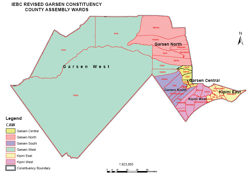
County Assembly Wards in Garsen Constituency:
Kipini East Ward
- County Assembly Ward No.:
- County Assembly Ward Name: Kipini East
- County Assembly Ward Population (Approx.):
- County Assembly Ward Area In Sq. Km (Approx.):
- County Assembly Ward Description: comprises part of
Garsen South Ward
- County Assembly Ward No.:
- County Assembly Ward Name: Garsen South
- County Assembly Ward Population (Approx.):
- County Assembly Ward Area In Sq. Km (Approx.):
- County Assembly Ward Description: comprises part of
Kipini West Ward
- County Assembly Ward No.:
- County Assembly Ward Name: Kipini West
- County Assembly Ward Population (Approx.):
- County Assembly Ward Area In Sq. Km (Approx.):
- County Assembly Ward Description: comprises part of
Garsen Central Ward
- County Assembly Ward No.:
- County Assembly Ward Name: Garsen Central
- County Assembly Ward Population (Approx.):
- County Assembly Ward Area In Sq. Km (Approx.):
- County Assembly Ward Description: comprises part of
Garsen West Ward
- County Assembly Ward No.:
- County Assembly Ward Name: Garsen West
- County Assembly Ward Population (Approx.):
- County Assembly Ward Area In Sq. Km (Approx.):
- County Assembly Ward Description: comprises part of
Garsen North Ward
- County Assembly Ward No.:
- County Assembly Ward Name: Garsen North
- County Assembly Ward Population (Approx.):
- County Assembly Ward Area In Sq. Km (Approx.):
- County Assembly Ward Description: comprises part of